The intelligent coastal and maritime defense solution is a comprehensive solution designed to meet the needs of national coastal and maritime defense management. This solution uses advanced information technology, Internet of Things technology, and big data analysis to achieve real-time monitoring, early warning, command and dispatch, and emergency handling of coastal and maritime areas, effectively improving the management efficiency and ability of coastal and maritime defense management departments to respond to emergencies.
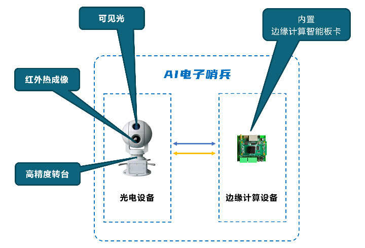
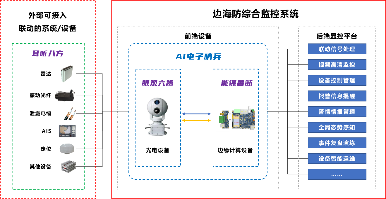
The new generation of coastal and maritime defense system is composed of visible light, infrared thermal imaging, high-precision turntables, and edge computing intelligent boards. The coastal and maritime defense system forms its own product system. At the same time, using the natural attributes of the visualization capabilities of photoelectric equipment, through the idea of fusion, it realizes the linkage of multiple sources at the front end of the site through access; with the support of AI algorithm capabilities, it realizes target recognition and automatic tracking, improves the reconnaissance and surveillance capabilities of key areas, and provides strong support for meeting the needs of border control, counter-terrorism and stability maintenance, and emergency handling.
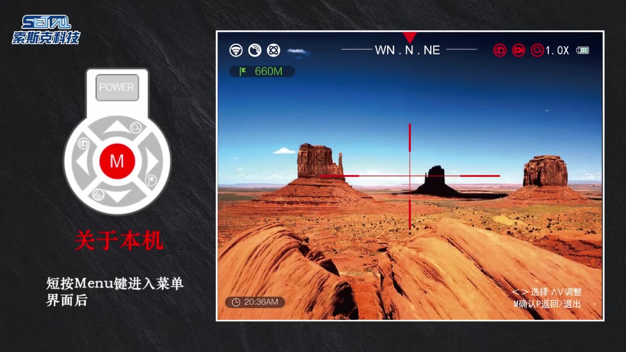
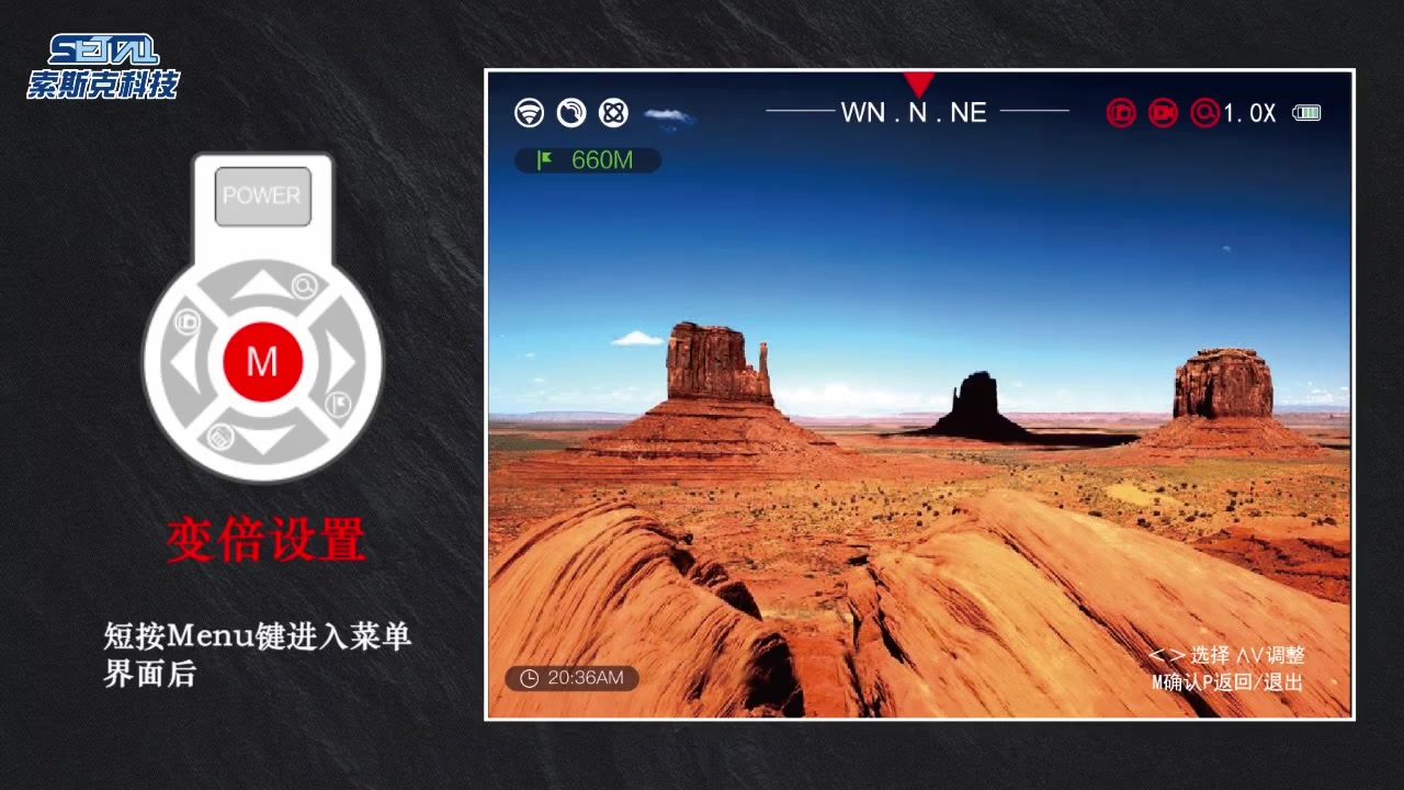
Core Functions
Multi-source heterogeneous data fusion, information sharing, and early warning linkage
Give full play to the advantages of various security systems:
Radar, AIS, vibration fiber, etc., for large-area search and coverage
AI photoelectric turntable: 24/7 visual patrol, AI intelligent analysis
Break down information barriers, achieve information sharing, improve the comprehensive utilization rate of data, and form an intelligent, precise, and efficient comprehensive analysis and judgment
Radar and photoelectric turntable
Vibration fiber and photoelectric turntable
AIS and photoelectric turntable
Security fixed camera and photoelectric turntable
New generation AI technology, accurate identification, high-intelligence judgment
The command center is equipped with "never-tired" 24-hour on-duty personnel, changing passive monitoring to active early warning, achieving the goal of "prevention, processing, and post-event analysis." Comprehensive use of advanced technologies such as edge computing and AI photoelectric turntables to automatically identify and classify early warning events, automatically filter useless information, greatly improving the work efficiency of on-duty personnel, and allowing coastal defense monitoring station personnel to focus on "valuable" work.
Truly achieve "intelligent devices staring at the front end, people staring at intelligent devices," greatly improving the efficiency of border control.
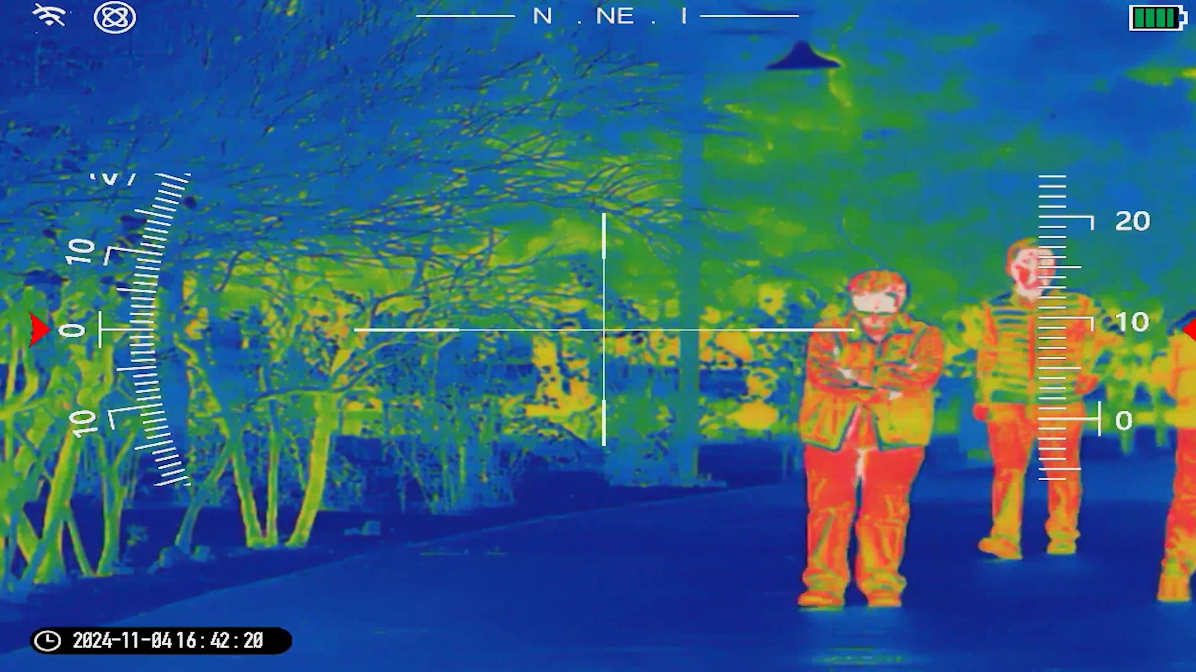
Automatic tracking of the target throughout the event, automatic retention of multi-dimensional evidence, providing effective data support for post-event analysis.
Automatic zoom and target attribute overlay, providing detailed details to assist users in decision-making.
AI optimized tracking algorithm, continuous and stable tracking
Continue tracking after occlusion
Tracking recall after loss
Multi-dimensional situation presentation, global visualization
Remotely control the visual situation of coastal defense, improve the command center's control over the on-site situation, and issue more accurate instructions, allowing on-site personnel to handle the situation reasonably.
Event full process recording and traceability
Quickly browse important events that occurred in the border area
Focus on key content, showing the event process and information
Analyze event targets, manual secondary judgment
Technical Highlights
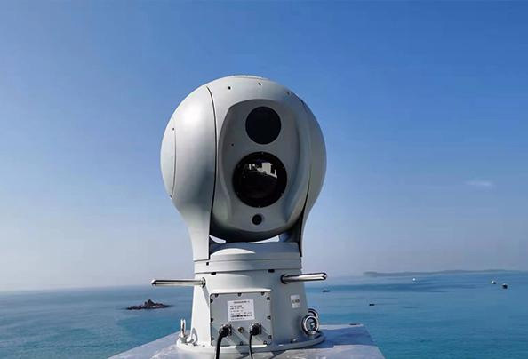
The system uses advanced ultra-long-range optical fog-penetrating technology, far-infrared thermal imaging technology, laser-assisted illumination technology, anti-wind and anti-shake technology, and marine anti-corrosion technology to effectively prevent the impact of coastal typhoon seasons, strong winds, and ship shaking on video, and reduce the damage caused by strong winds to front-end equipment, while obtaining stable and high-quality video images. The system has the following characteristics:
By building monitoring system equipment on the coastline, offshore waters, islands, or on law enforcement vessels, 24/7 imaging is achieved, and the use of sea areas, maritime management safety, maritime border defense safety, maritime defense safety, and the safety of surrounding maritime cargo ships are dynamically visualized and monitored in real time.
In the monitoring and command center, ship tracking management software, navigation dynamic monitoring software, sea surface anti-intrusion monitoring software, or ship intrusion identification and early warning software are used to achieve real-time monitoring, recording, remote control, alarm processing, and permission allocation of multiple screens at various monitoring points in various application fields.
Ensure effective management of sea areas; monitoring of pollutant discharge into the sea; mussel monitoring; monitoring of river pollutant inlets; monitoring of mariculture areas; monitoring of marine protected areas and bathing beaches; dumping areas and oil and gas areas; protection monitoring of bays, estuaries, and coastal wetlands; monitoring of red tides and toxic red tide areas; monitoring of environmental quality in dumping areas and oil and gas areas; monitoring of islands and island ecological environments, etc.
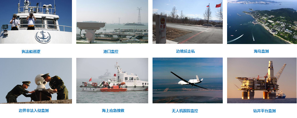
Applicable Scenarios
Summary
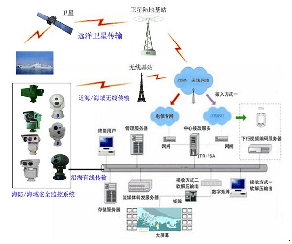
This system comprehensively uses satellite communication, electronic charts, geographic information systems, wireless communication, broadband networks, computer modeling, multimedia, and other technologies for the business processes, safety production, and dynamic monitoring of sea areas/coastlines/coastal defense/coastal operation areas, realizing visualized video management and auxiliary decision-making services that are digital, networked, intelligent, and intelligent. It is an integration of information infrastructure and information systems, responsible for 24/7 real-time monitoring of the status of navigation marks on sea areas/channels, the navigation conditions of passing ships, dynamic monitoring and management of sea areas, illegal reclamation, identification and early warning management of sea use, and production management of coastal operation areas. It uses wireless digital communication technology combined with fiber optic communication technology, digital video processing technology, intelligent visual analysis technology, and dynamic monitoring and early warning technology.
The system can be used normally under various climatic conditions and at night without illumination, achieving 24-hour real-time recording of sea/ocean conditions, timely discovery of ship navigation conditions, illegal sand mining, illegal reclamation/sea use, random sewage discharge into the sea, illegal island development, and cross-border fishing by foreign fishermen, providing good intelligent assistance for channel smoothness, effective management of sea areas/islands, and maritime border defense management.
Recommended Products
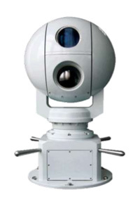
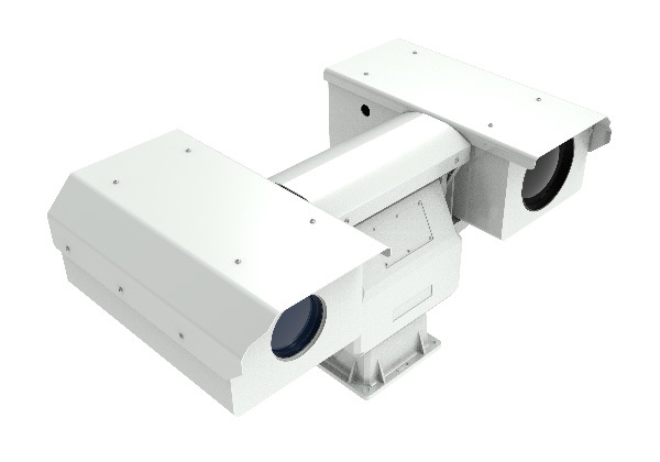
High-definition ultra-long-range split three-band night vision system SSK/NW-IRST5000
High-precision intelligent PTZ:
1. The overall design adopts an integrated design, and the overall structure is compact and beautiful;
2. Vertical angle maximum -45°~ +45°, the angle can be set as needed;
3. Horizontal 0.1~30°/S, vertical 0.1~15°/S, preset position accuracy +/-0.1°/S;